Pioneering Performance-Based Navigation

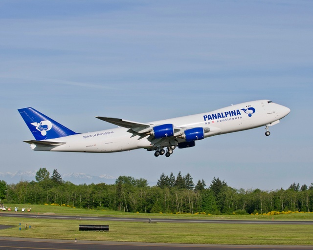
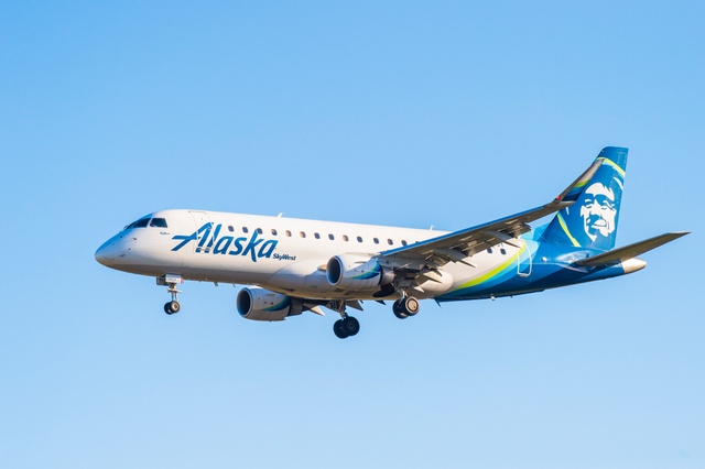
In the mid-'90s, Alaska Airlines went all in on a new navigation strategy aided by satellites that allowed its pilots to perform more precise, tailored approaches to some of the airports they frequented.
Dubbed “performance-based navigation” or PBN, the concept coupled existing avionics and navigational equipment on board the company’s fleet of Boeing 737s with GPS and other satellite constellations to precisely fix an aircraft’s position and desired approach in three dimensions.
“Performance-based navigation alludes to the equipment on the aircraft having a performance criteria that the airplane has to meet to assure that that airplane is where it thinks it is in space,” Bret Peyton, managing director of standards, fleet and operational control at Alaska Airlines told Avionics. “That criteria becomes RNP or required navigation performance. That's the box that your satellite accuracy has to remain within, so you don't run into a mountain or something like that.”
The RNP is represented by a three-dimensional “bubble” inside which the aircraft should fly using navigational data from satellites instead of ground-based aids to navigation, he said. This shift from terrestrial nav aids to satellites created a “sea change in how we navigated in the early ‘90s,” Peyton, who is also a pilot, said in an interview during the 2023 Connected Aviation Intelligence Summit in Denver.
“The advantage of PBN is you can do things like curved paths in space,” he said. “A ground-based navigational aid, a traditional way to navigate—and we still use them—gives you straight lines that you can navigate on, usually straight lines out of the ground for glide path or straight lines in the air for an airway. And that's fine and good. But when you get into things like terrain constraint airports, you know, a straight line won't work.”
Alaska’s 737s were already equipped with the necessary avionics and navigational tools to harness the accuracy of steering by satellite so the airline applied PBN, actually RNP, to its approaches to Juneau. The airport there is remote and surrounded by extreme terrain, which can make landing difficult in the best of conditions, Peyton said.
“We did we did some investigation on building approaches into and departures out of Juneau that wouldn't meet public FAA criteria,” he said. “They were really tight. And if you look at the terrain around, you know, there's the Gastineau channel, it's really narrow, and we built approaches and departures that flew down that and we did that in a compliant manner with FAA approval because we had one aircraft type.”
“The thing with RMP is, you have to design it to the worst flight management system, the worst navigation system out there if it's public,” he added. “But if you have a common airplane, and in our case, it was a 737, it’s more of a known.”
To this day, Alaska Air Group airplanes—Alaska and its subsidiary regional carrier Horizon—are the only aircraft cleared to fly those PBN routes into Juneau. The airline has now developed 63 approach and departure procedures throughout Alaska and in the lower 48 states, as well, he said.
Although GPS satellites are situated in medium earth orbit—about 12,000 miles above Earth—that regime, at least for commercial airline connectivity applications is being supplanted by proliferating low-earth orbit satellites, space company officials said at the summit. Orbiting about 1,200 miles up, LEO sats are mainly used for data transfer and in-flight connectivity but have multiple use cases, said Ronald van der Breggen, chief commercial officer for Rivada Space Networks.
“The long and short of it is there are multiple use cases and I think I'm speaking for everybody here, also beyond aviation,” he said when asked if LEO satellites could be employed as aids to navigation.
Jason Sperry, head of business aviation at OneWeb, agreed, but said his company is not actively exploring safety-specific applications for the increase in bandwidth afforded by the explosion of LEO satellites.
“From our perspective, we see that there are other applications onboard the aircraft that can certainly use connectivity,” he said. “I think, you know, I speak for everyone here that we don't have a foray right now into branching into an elven safety services type avenue.”
Other airlines and airport operators have jumped on the bandwagon and the use of PBN is fairly common now. For instance at San Diego International Airport, there are public RNP procedures available to all aircraft and all airlines, Peyton said.
Often, a PBN or RNP approach is the most efficient in an airport or along an air route, making it a prime technology for reducing fuel consumption and other efficiencies airlines are chasing. PBN approaches usually involve the shortest safe flight path into and out of an airport so airplanes can power down and save gas.

The system also can be used to reduce noise pollution, as Alaska does in Santa Barbara, California, where its proprietary approach procedure not only minimizes track miles into town but also avoids blasting houses along the coast with jet noise, Peyton said.
“It's a multi-tool, but you have to have a program, you have to have an approved program,” he said. “That's hard to do. There's a lot of heavy math involved. You have to have smart people to design this stuff right and you have to make that commitment and some airlines have. But most folks just have a very small program on one or two airports.”
Available worldwide through GPS, low-earth-orbit (LEO) satellites and others, there is now little concern for satellite switching or blackouts in many of the largest airports around the globe. Air traffic control in both Denver and Houston use PBN and RNP regularly to space aircraft in the most efficient manner. It also takes some burden off controllers, Peyton said.
“It's a very efficient way for controllers to put somebody on a procedure and sort of not forget about them, they have to watch them less than in visual condition,” he said. “Denver has been really good in using public procedures there. It can be advantageous to increasing throughput at airports.”
Ryan Stone, president of SmartSky Networks, laid out a scenario at Heathrow Airport in London that often occurs when planes leave the U.S. and are on time or ahead of schedule. They are placed into a winding holding pattern over the airport until they can land, burning fuel and congesting the airspace.
By tackling issues like this well-known one, airlines and the industry can save significant dollars. By creating just 10 percent more efficient routing, the industry could emit 3 percent less carbon, which doesn’t sound like much but translates into $21.5 billion a year industry-wide, he said at the summit.

Using SmartSky’s five-dimensional trajectory-based operations, which are patented algorithms that fix a plane in three physical dimensions plus time, “you can optimize your trajectory based against constraints—we've modeled this—we know we can save between 5 to 15% on fuel,” he said. “That's dramatic because you're cutting the time of those flights.”
A lot of work remains to broaden acceptance of PBN and RNP approaches before every, or even most airports are reaping the efficiencies to the greatest extent possible.
Not all flight management system computers can handle the complex algorithms required to perform these approaches, which leaves many legacy jets operated by regional carriers unable to take advantage, he said.
There are competing airspace modernization technologies being deployed throughout the National Airspace that don’t necessarily cancel PBN out but must be layered to improve situational awareness and air traffic control, Peyton said.
“It's gonna be some time before we get legacy systems out in the airline sphere,” he said. “I can't speak for [business aviation] too much but I think they're almost all equipped.”