‘Detecting’ the Path to BVLOS Operations for Commercial Drones in US Airspace
Interviews with commercial drone technology providers provide a roadmap to how BVLOS operations can be achieved within the U.S. National Air Space system.


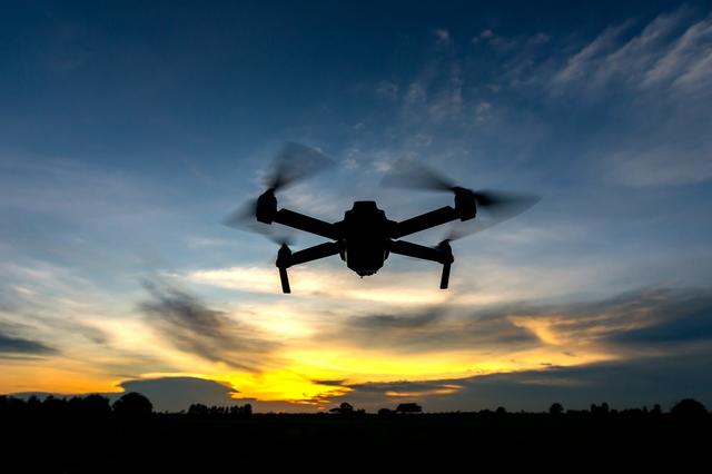
The full commercial potential of drones in civilian airspace in the United States is, for the moment, locked, as drones are unable to fly beyond their operator’s visual line of sight (BVLOS), without waivers from the FAA.
Today, these waivers typically require non-scalable solutions like visual observers or chase aircraft. Many commercial applications of drone technology, including drone delivery — which companies including Alphabet’s Wing, Amazon and UPS are hoping to roll out in the next few years — cannot be economically viable under this framework.
Progress is being made toward integrating small drones into the airspace and regulator approval of BVLOS flights, but it is proceeding slowly, in accordance with the FAA’s “crawl, walk, run” approach. In the meantime, many companies in the industry whose business models rely on BVLOS approval have shuttered operations, unable to sustain themselves while the pieces come together.
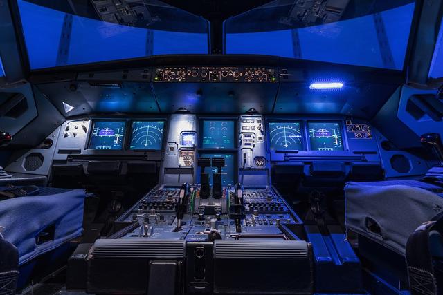
The FAA requires and entrusts the pilot of a traditional aircraft to “see and avoid” other aircraft in the sky, either visually or using onboard instruments, in order to avoid near-misses and collisions. Applying the same standard to drones means that, for the moment, the remote pilot — or a visual observer that acts as an extension of the pilot’s eyes — must have line of sight to the drone.
A New Industry Being Established
This past summer, the FAA permitted a few companies taking part in its UAS Integrated Pilot Program, or IPP, to make groundbreaking BVLOS flights that used onboard detect-and-avoid (DAA) systems to ensure the safety of the drone and the airspace around it.
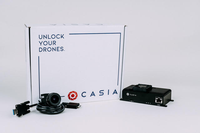
One such flight by the Kansas Department of Transportation used Casia, a DAA package created by computer vision startup Iris Automation, to conduct a nine-mile BVLOS inspection of transmission lines without visual observers or ground-based radar systems.
Casia, which weighs 300 grams and costs less than $10,000, uses an off-the-shelf camera and processor — along with computer vision and artificial intelligence — to detect and classify far away objects more accurately than a human. Its AI-driven categorization uses non-deterministic thought, but relies on a pre-determined ‘dictionary’ of maneuvers to react to intruding aircraft.
“From when we started building the technology, we were very intentional about not just having one big AI algorithm, one end-to-end deep neural net that controls the whole thing,” Alexander Harmsen, CEO and co-founder of Iris Automation, told Avionics International. “We have a mix of geometric, deterministic algorithms that rely on pixels and tracking — sort of traditional computer vision — together with more machine learning, AI to be able to add semantic understanding [and] things like classification systems.”
Harmsen, who worked on computer vision technology at NASA’s Jet Propulsion Laboratory before founding Iris, said that design has been critical to convincing regulators of Casia’s safety.
“The FAA and different aviation authorities around the world, they want to be able to pull it apart and understand what’s happening under the hood,” Harmsen said.
Using a limited dictionary of reaction maneuvers also allows Casia’s movements to be proven safe via simulation and flight testing, which wouldn’t be possible if the system’s output options were unlimited. Amazon’s FAA filing for Part 135 certification for drone delivery services, submitted in August 2019, describes a similar DAA system.
DAA systems such as Casia often combine a number of sensory inputs to understand the airspace surrounding the drone. ModalAI, a drone startup working with UberEats delivery drones in San Diego, relies on computer vision as standard configuration “but has a lot of expandable [inputs and outputs] to integrate other sensors such as radar,” said Chad Sweet, CEO of ModalAI.
The Role of UTM in BVLOS
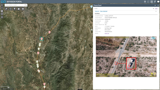
Many DAA systems also integrate ADS-B to track traditional aircraft as well as inputs from unmanned traffic management (UTM) services such as Altitude Angel and AirMap, where drone operators can file flight plans ahead of schedule.
These UTM services are playing a critical role in unlocking BVLOS operations as well, gathering data to understand airspace activity in real-time which can then be used to oversee low-altitude drone operations. AirMap’s system draws data from many sources, including airplanes and drones outfitted with ADS-B Out, ground-based radar systems as well as The Weather Company, which offers hyperlocal weather data for drone operators.
“In dense or controlled airspace, automatic deconfliction provided by [UTM services] … will help airspace managers ensure safe routing of low altitude traffic,” said Ben Marcus, co-founder and chairman of AirMap. “There are already a number of regular BVLOS operations running under UTM supervision in several countries [and] North Carolina with AirMap.”

UTM supervision may fulfill for drones the function that air traffic control does for traditional aircraft in controlled airspace, approving and re-routing flights in an automated fashion, but under the current FAA framework drones will still be responsible for “seeing and avoiding” threats themselves — and that’s where onboard DAA systems come into play.
“We think that both systems are complementary and will eventually work together to provide the level of safety required by each type of operation and the type of airspace they use,” Marcus told Avionics. “In some cases, redundancy between automated deconfliction and onboard DAA systems will be required to ensure maximum safety. In other cases, maybe only UTM supervision or DAA will be needed.”
Remote drone identification, which the FAA plans to release a regulatory framework for in December, will provide additional tracking information for UTM services to draw from, and many companies Avionics spoke with view it as a foundational element of future BVLOS operations. But Chinese drone-maker DJI is opposed to mandatory tracking, stating privacy concerns.
“We strongly disagree with the idea that the future of drones involves every drone automatically being tracked in a nationwide database and stored until the end of time,” Adam Lisberg, DJI’s head representative for global policy and regulatory issues told Avionics. “If you’re a site selection company, do you want data on all the flights you’ve ever flown on behalf of companies trying to get an advantage on where to locate a gas station or a shopping mall … stored in a nationwide database, under the assumption that every database sooner or later will get hacked?”
Lisberg noted that some UTM systems envision all drones equipped with an LTE chip and possibly paying for a LTE data plan, which DJI views as “contrary to the interests of many pilots.”
Crucial to BVLOS flight as well is maintaining active communications over long distances, a problem that can be solved via cellular networks, satellite connectivity or other solutions. But drones must be able to maintain safe operations even if communication channels are interrupted, and UTM supervision requires constant connectivity to cloud services in order to deconflict in real-time.
“Our system doesn’t need an active communication system to link back to the cloud,” said Iris Automation’s Harmsen.
More Testing
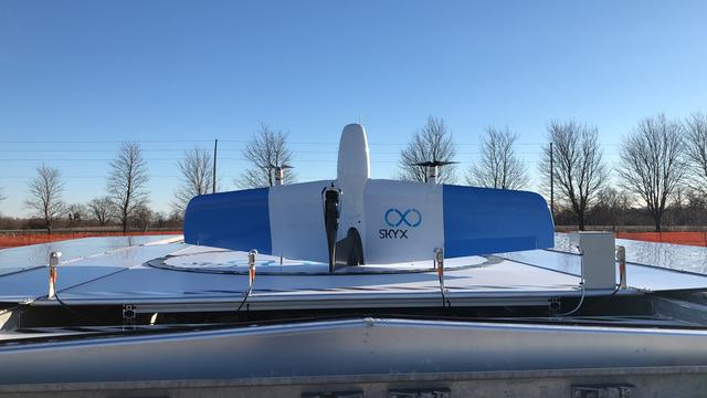
As the onboard DAA and UTM supervisory elements come together, commercial UAV companies like Ontario-based SkyX are providing services around the globe — just not in countries with crowded, controlled airspace like the United States.
SkyX offers long-range asset monitoring services using a tail-sitting, fixed-wing eVTOL drone that can fly up to 65 miles on a single charge. Most of its work to date has been pipeline inspection services for oil-and-gas companies, for which BVLOS operations have been performed in countries across four continents, according to SkyX Chief Technology Officer Jason Braverman.
“Since we only operate on Rights of Way, we never fly the drone over any public areas, as a result we are far less likely to have an incident with a person or other vehicle,” Braverman said.
There is plenty of work for SkyX in isolated areas with uncontrolled airspace, where robust detect-and-avoid systems aren’t necessary to ensure safe operations or adhere to local regulatory standards. But SkyX does hope to offer its services in more complicated airspace in the near future, and the company has not yet found a commercial DAA system that serves its needs.
“I can tell you that SkyX has worked with a number of industry systems including onboard radar- and computer vision-based systems like Iris Automation, and finally ADS-B,” Braverman told Avionics. “Each has their own flaws, and none of them are usable for a UAV moving at 100km/h below 500ft AGL.”
“If you are flying over densely populated areas, for example rail tracks leading into a major city like New York, then it makes perfect sense to have a system which can be aware of anything near it within 2,500 feet that might intercept the drone and cause a collision … it’s becoming clear that a complete system will require a 360-degree view.”
Braverman said SkyX has a unique solution in the research and development stage, aiming for production in 2020, that the company hopes will “improve our chances of operating BVLOS regularly in North America, European Union and Australia.”
When will the puzzle pieces of scalable BVLOS operations come together, and what will the enabling technologies and regulatory requirements be?
“That’s the million-dollar question,” said Michael Blades, vice president of aerospace, defense and security at Frost & Sullivan. “There are [Light Detection and Ranging] LIDAR and [Radio Detection and Ranging] RADAR and Electro-Optical/Infra-Red solutions out there, but which will be the answer? Will there also be a ground-based element? Until we know what the standards will be I think it is hard to say, and I don’t think there will be standards developed until there has been a lot more testing.”
There is widespread consensus that onboard DAA will be required for fully autonomous operations, according to Blades.
“To implement true, waiver-free BVLOS, an onboard system for avoiding other aircraft will almost surely be a requirement,” he said. “There will be things operating in the air such as hot air balloons and kites that can’t be avoided in any way besides an onboard set of sensors.”